
by Emily Rinaman, Catalog Librarian
The Sandusky River winds its way through Wyandot, Seneca and Sandusky County. It’s the most defining water feature of Seneca County and it’s age is thousands of years older than any of the county’s living inhabitants. In fact, the river has provided life of several species besides humans for hundreds of years.
All of the creeks, tributaries and rivers, including the Sandusky River, are part of the remnants of a once massive glacier which covered Northwest Ohio. They all now flow north into Lake Erie, another remnant of the glacier. The Sandusky River forms the eastern boundary of the Great Black Swamp. The retreating glacier left behind “fertile” soil and a modern drainage system suitable for many crops.
“Wolves seem to be more numerous in Seneca than in any adjoining county. They were found most plentiful along the Sandusky River and along the several branches of Wolf Creek,” states Bascom Then and Now. “Very appropriately the creek was named for them.”
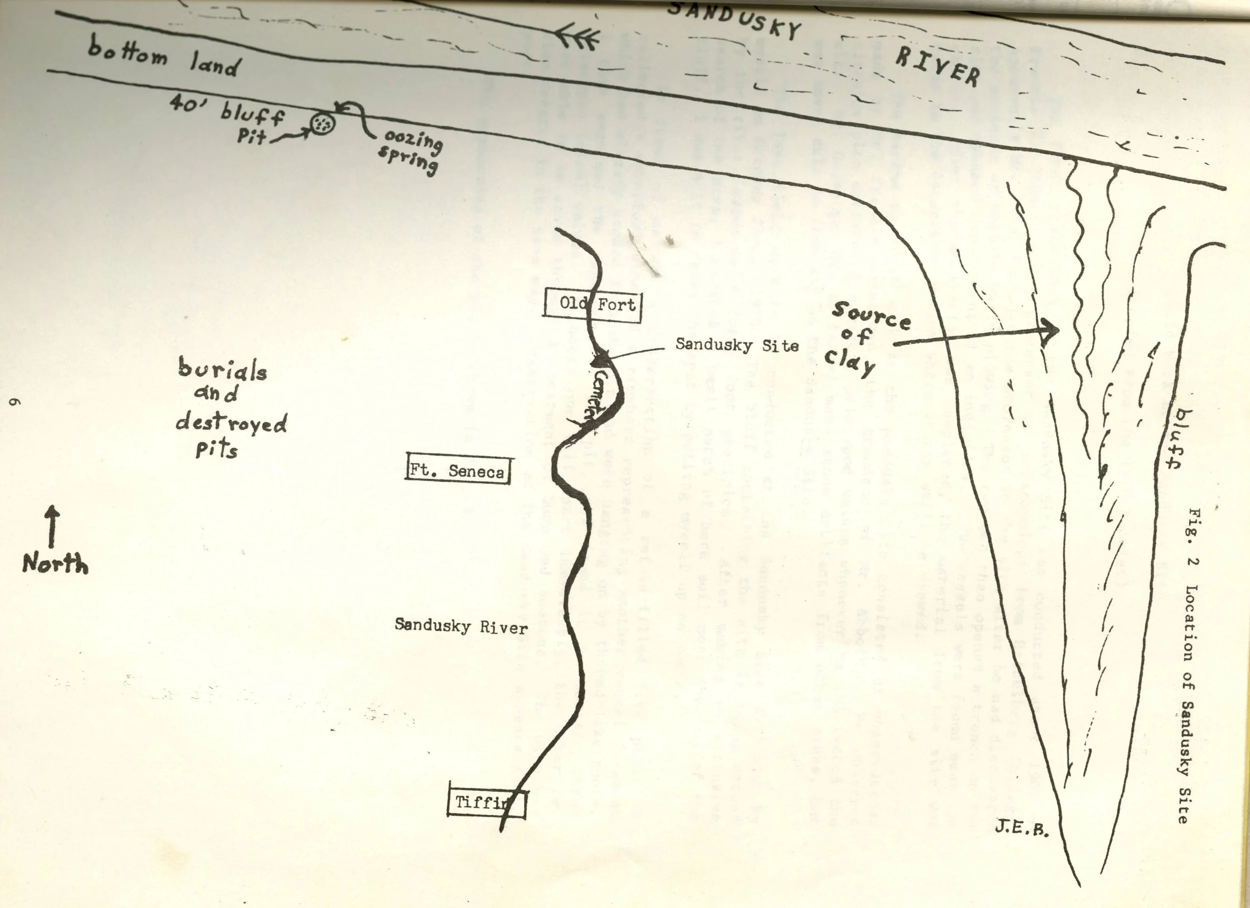
In relation to the Sandusky River, this drawing displays where a prehistoric site was found near Old Fort, Ohio.
Wolf Creek, along with Rock Creek, Muskellunge Creek and Muddy Creek in Sandusky County are all part of the Lower Sandusky River Watershed, according to the Ohio Environmental Protection Agency. Cultivated Crops now make up three quarters of the land surrounding the river in these two counties, followed by urban land at 12 percent and forest at 6 percent.
At the time that wolves would have roamed the area, however, forested areas would have been much more plentiful, which teemed with wildlife such as raccoon and woodchucks (groundhogs).
Smallmouth bass, catfish and muskellunge have been stocked at one time or another by the Ohio Division of Wildlife to help the river rebound.
In Seneca County near Old Fort, a prehistoric site was uncovered in the 20th century with remnants of several animal bones that served as food for prehistoric Native Americans. This site dates to 1100 A.D. and “was situated in a forest of elm, ash, maple, hickory and beech,” explains the Sandusky Site Near Old Fort document. It was located at a site where small rapids in the Sandusky River provided a haven for walleye and white bass. Other animals that inhabited the river area during this era were elk, bear, panthers and beavers (in addition to wolves).
Later, the Sandusky River was inhabited by Wyandot and Huron tribes, particularly in the area of Honey Creek. Their villages were built along the river and its tributaries, more closer to Wyandot County. They would use the Sandusky River area as hunting grounds, just as their predecessors did, often for months at a time.
Honey Creek and Rocky Creek meander 12 miles from the Sandusky River in a west and southwest direction. In Eden Township it absorbs Silver Creek.
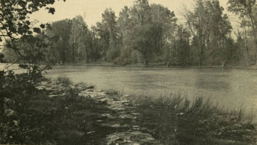
A view of the Sandusky River, published on the front of “Down the Sandusky with Ray Grob”, which has been digitized on the SCDL.
Other creeks include Willow, Morrison, Spicer and Sugar Creeks. Some of these make up the Sandusky River Upper Basin.
According to the Ohio Division of Natural Resources, the Sandusky River is one of the longest rivers in the Lake Erie watershed. After the removal of St. John’s dam, “an increased diverse aquatic habitat” has rebounded.
At one time there were four forts along the banks involved in the War of 1812, including Fort Ball and Fort Stephenson (Fremont).
In fact, State Route 53 which runs parallel to the river from Upper Sandusky to Fremont was a former trail called Army Road. It was the first major road within the area.
By 1818, a treaty between the natives and soldiers was held at the foot of rapids of another river in Northwest Ohio, the Miami, to divide the lands in the area, including Seneca County.
Today, the area, with its modern roads and buildings may look different than 100 or 200 years ago, the areas along the Sandusky River and creeks may not look as different as when the wolves and natives roamed the land.
Works cited:
Bascom Garden Club. “Bascom Then and Now”. 1976. Seneca County Digital Library. https://ohiomemory.org/digital/collection/p15005coll27/id/29193
Dildine, Frank. “From Wilderness to City.” https://ohiomemory.org/digital/collection/p15005coll27/id/22177
“75th Anniversary Souvenir”. 1897. Seneca County Digital Library. https://www.ohiomemory.org/digital/collection/p15005coll27/id/22962/rec/2
Baughman, A.J. “Seneca County History Volume 1.” 1911. https://ohiomemory.org/digital/collection/p15005coll27/id/17316
Bowen, J.E. “Sandusky Site Near Old Fort”. 1983. https://ohiomemory.org/digital/collection/p15005coll27/id/29790
Grob, Ray. “Down the Sandusky with Ray Grob.” 1971. https://ohiomemory.org/digital/collection/p15005coll27/id/30654
Ohio Division of Natural Resources. https://ohiodnr.gov/go-and-do/plan-a-visit/find-a-property/sandusky-scenic-river
Ohio Environmental Protection Agency.