
by Emily Rinaman, Catalog Librarian
Imagine yourself walking through a park. The loud buzzing sound permeates the air above you. You look up expecting to see a huge bug, but once you locate the source of the noise, you realize it’s just a drone hovering over the park. A scene like this is pretty common at this point in the 21st century. Through modern technology and social media we have become used to seeing landscapes, cities, houses for sale, fireworks displays, carnivals and anything you can imagine from a birds-eye view.
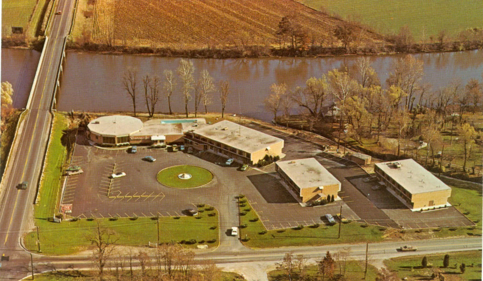
An aerial view of Riverview Inn at the corner of SR 224 and SR 53 in southwest Tiffin, Ohio.
Just a few short decades ago, however, opportunities to see our homes and towns from above weren’t as commonplace.
Once the field of aviation advanced with humans being able to fly in airplanes and helicopters, a trend was born. Professional aerial photographers were often employed to take aerial photographs for businesses and the like.
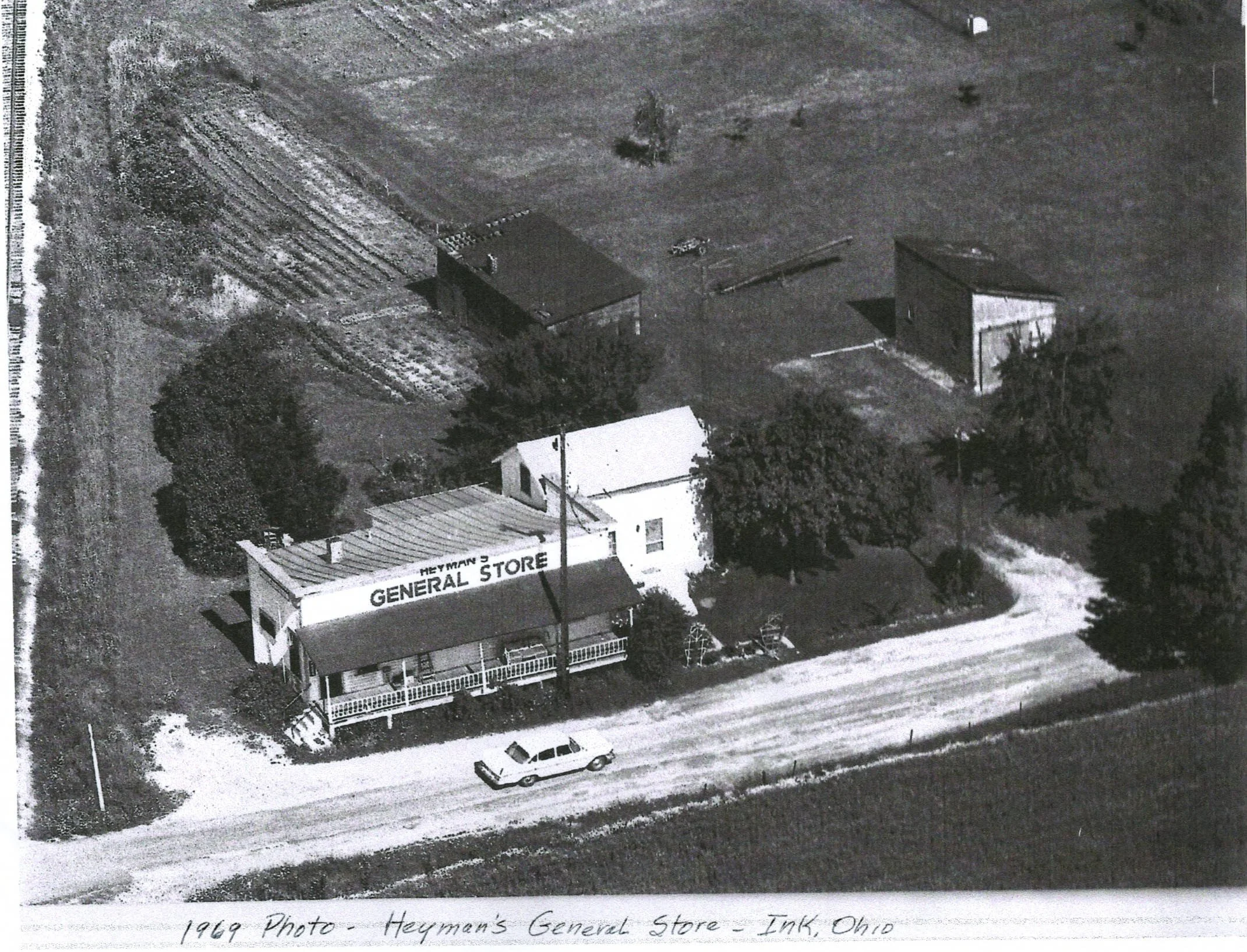
An aerial view of Heyman’s General Store in the former village of Ink in Seneca County in 1969.
Surprisingly, this trend developed slower than what most might think. Contrary to what some might believe, it didn’t happen overnight. As far back as the early 1900s, a gentleman named Wilbur Wright was assigned to take an aerial shot of a military farm near Rome, Italy. Prior to that, scientists used rockets and compressed air to shoot a camera into the air to take photographs (by none other than Alfred Nobel).
Other objects used in the last few centuries to try to take aerial photographs include kites, pigeons and hot air balloons. In fact, a camera attached to a kite is the secret behind how aerial views of the devastating 1906 San Francisco earthquake were created.
Aerial photographs aid surveyors and mapmakers in designing accurate maps and blueprints. They may also be used for recovery efforts after a natural disaster and are one of the most practical uses for drones today.
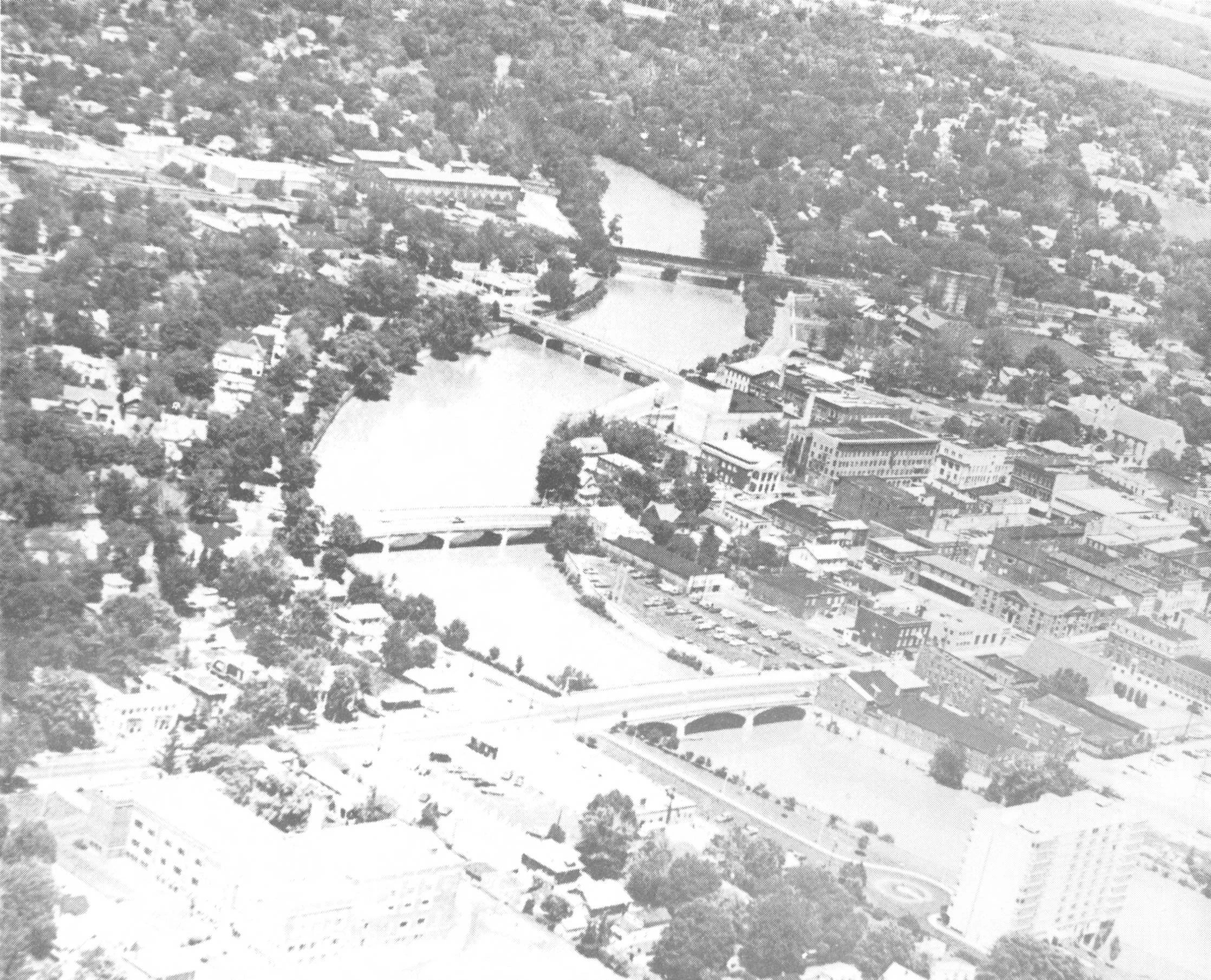
An aerial view of the winding path of the Sandusky River through Tiffin, Ohio. A devasting flood in 1913 resulted in the widening of the river after it swept some of the old downtown bridges away.
In the cultural heritage field, overlapping historical maps with modern maps are providing historical context to the changes that happen over time in our environment and living spaces. The Ohio Department of Transportation’s Office of CADD and Mapping Services has developed a website containing a half million images of Aerial Imagery you can view.
Aerial photography was prevalent in Tiffin, and you can find several aerial shots of different places in Seneca County by viewing the Tiffin-Seneca Sesquicentennial book that was compiled in 1967 and is available on the Seneca County Digital Library.
Another website to peruse which contains local aerial photographs is the “Vintage Aerial” website, a compilation of professional aerial photographs that have been taken over the years.
If you are technologically adept, you may enjoy a website called “Historical Aerials” that has an overlapping feature up to 2021.
See the Works Cited section for links to these resources.
Works cited:
Ohio Department of Transportation. Office of CADD and Mapping Services. Aerial Imagery Archive. https://www.transportation.ohio.gov/working/engineering/cadd-mapping/survey/aerial-imagery
Centennial Committee of Seneca County, Ohio. Tiffin-Seneca Sesquicentennial, 1817 – 1967. Seneca County Digital Library. https://ohiomemory.org/digital/collection/p15005coll27/id/25130
Professional Aerial Photographer’s Association International. “History of Aerial Photography”. https://papa.clubexpress.com/content.aspx?page_id=22&club_id=808138&module_id=158950
Tom Root Air Photos. Riverview Inn Postcard. Seneca County Digital Library. https://ohiomemory.org/digital/collection/p15005coll27/id/27259
Vintage Aerial. “Seneca County.” https://vintageaerial.com/photos/ohio/seneca
Wickiser, Bernice (Goshe). “Village of Ink.” https://ohiomemory.org/digital/collection/p15005coll27/id/32006