
By Emily Rinaman, Technical Services Librarian
April 25 marks the 120th anniversary of the first license plate, so this month, we are taking the term a bit more literally and driving--I mean, diving--into the history of the development of roads. Additionally, the introduction of highway numbers began in March almost 96 years ago.
If you recall (I mean, how could anyone forget?) at this point last year, the entire country had been in lockdown mode for a month, and the traffic, as reported by the few still traveling on them, was sparse. We were all stuck at home, not by a Level 3 blizzard, but by a microscopic virus brought to America on a plane, not a car. During that time, we, as a whole but also as individuals, realized certain aspects of our lives that we had been taking for granted. One of those was the freedom to roam freely. As the boredom and cabin fever set in, many families took scenic drives just to get out of the house for a while. By that point, many were tickled to be stuck in a car instead.

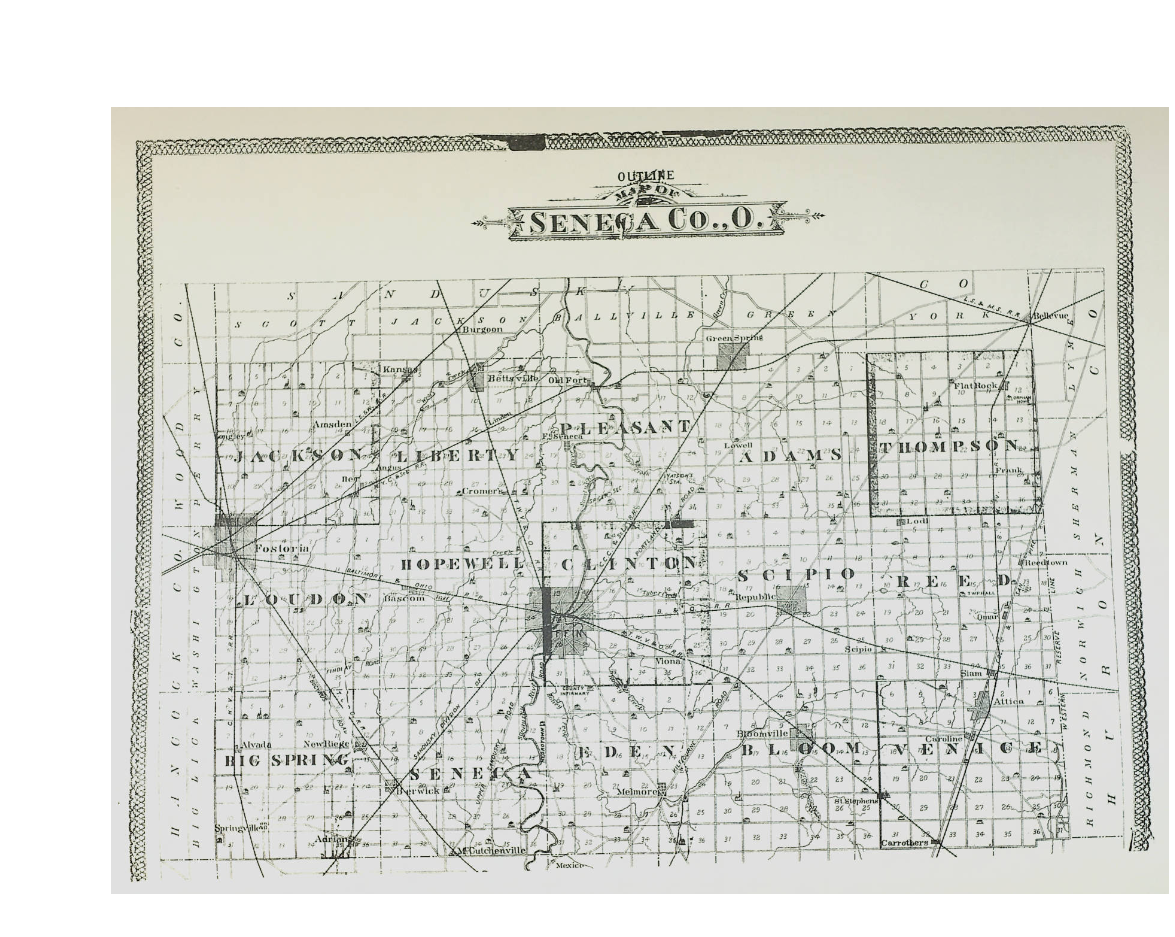
Seneca County's first official road was State Route 53, but was known by many names--the Harrison Trail, the Army Road and the Pan Yan. It was commissioned as a state route in 1821. Other early roads in the area were Morrison Road, Portland Road (SR 101), Kilbourne Road (SR 18), and Mohawk Road (SR 231). They were named after notable people or groups who either lived or played a part in the area's history.
Later, roads were named based on their starting and ending points. State Route 12 was known as the Findlay State Road from Bettsville to Findlay, and State Route 18 was known as the Defiance and Tiffin Road. On the western edge of Seneca County, US 23 was called the Bucyrus and Perrysburg State Road. State Route 4 was known as the Sandusky and Columbus Turnpike.
Even after these major roadways gained numerical codes, they often retained their names as a secondary measure. Many in Tiffin and Seneca County may remember referring to SR 53 as "Plank Road." This major route, however, was not the only one in the area to be converted to wooden planks before being paved in the early 20th century. Our very own "Plank Road" was in a system of over 200 plank roads in the state.
Plank roads or "corduroy" roads were a way to keep traffic moving during the cold, snowy winters of northern Ohio and hot, muddy summers. Because the area was so swampy in the 1800s, many of the state routes were developed along more elevated paths. State Routes 101, 18 and 12 all follow the sand ridges originally along their respective paths, and US 23 followed the higher ground from the Maumee River and Eastern branch of Portage River. The planks were typically 8 feet long and 2 inches thick and made from the trunks of locust, hemlock, tamarack, white oak, spruce and fir trees.
Plank roads were built overtop the existing dirt paths. According to the Ohio Department of Transportation, nine (plank road) companies were chartered during 1845, eight in 1848, thirty-seven in 1849, and eighty-nine in 1850. A general incorporation law was passed in 1851, allowing for any five people to form a plank road company. The Fremont, Tiffin, Fort Ball Plank Road Company was founded in 1849 and the Osceola Plank Company covered SR 18 from Tiffin to Fostoria. The Lower Sandusky Plank Road Company covered SR 53 from Fremont to Tiffin and SR 12 from the intersection of SR 53 and SR 12 to Findlay.
While interstate 80-90, or the Ohio Turnpike, is the only major road with tolls in the area today, plank roads often did have tolls. These tolls were intended to replace the rotted tree trunks used after the swampy conditions of the region caused them to detiorate quickly. Reedtown was once called Cook's Gate because a man whose surname was Cook operated a toll booth for SR 4. Bettsville also had a tollbooth for SR 12 named Phoenix Tavern. The charge was two cents per horse.
Turnpikes requiring payment were not a novel idea; however, by the time Ohioans started being required to pay tolls. The Pennsylvania Turnpike had already been around since the 1790s. That didn't stop a major debate from happening, though, between Tiffin's urban dwellers and Seneca County's rural inhabitants almost 100 years later. Howard Smith gathered newspaper articles together covering this ongoing saga and devoted an entire chapter to it in his book, The What, How And Who Of It: an Ohio Community in 1856-1880.
There are sayings that warn of history repeating itself, and you can't help but chuckle at how the same emotions, thoughts and concerns we all had (and still do) about how the "shelter in place" order in early 2020 were present in the minds and hearts of the individuals on both sides of the "Great Pike Debate", as the local journalists of the era dubbed it. They even list their very own "essential" workers: mail carriers, produce carriers (including those with butchered meat), grain millers (including hay for animals in town), sawyers (logs), hearse carriers, and those carrying fuel for heat (firewood or coal).

Firewood prices often spiked to "mud prices" during the rainy seasons. A bad winter in 1863 (of rain, not snow) caused Tiffin to have a firewood shortage (kind of like our toilet paper shortage in 2020). Some opponents said pike roads would cause them to have to shoe their horses--on dirt that wasn't necessary. (What do you mean I have to wear a mask?) People's reluctance to pay any additional taxes on roads led to newspaper columns stressing the "economic benefits of good (piked) roads." Tiffin business owners were worried about the loss of potential sales from people living in the outskirts, but the rural villages wanted to remain self-sufficient. It all came to a head in the spring 1880 ballot when the piked roads were shot down for good--Tiffinites voted 1,122 in favor and 269 against. Rural residents voted around 400 in favor, and around 4,700 against.
While brick roads were the successor of plank roads, especially in urban areas, they were short-lived. Most roads--brick, dirt and gravel alike--were covered with asphalt in the 1920s, 1930s, and 1940s.
Today, if one wants to travel somewhere and wants to know the conditions of the road, all he or she has to do is open a maps app on a smartphone or visit an interactive website like Ohio Department of Transportation which will provide "real-time traffic info" on traffic advisories like construction zones, weather forecasts and road closures. You can even get an estimated time of arrival with these situations factored in. Our journey to modern transportation sure has come a long way!
Works cited:
Bicentennial Sketches by Myron Barnes, https://www.ohiomemory.org/digital/collection/p15005coll27/id/33781/rec/2
Demrow, Carl. “Corduroy Roads”, February 25, 2011. https://northernwoodlands.org/articles/article/trick1
Economic History Association, “Turnpikes and Toll Roads in Nineteenth-Century America,” https://eh.net/encyclopedia/turnpikes-and-toll-roads-in-nineteenth-century-america/
Fostoria Centennial Souvenir Program and History, 1954, https://www.ohiomemory.org/digital/collection/p15005coll27/id/31551/rec/1
History of Bettsville, Ohio, https://www.ohiomemory.org/digital/collection/p15005coll27/id/29509/rec/8
History of Seneca County from the Close of the Revolutionary War to July 1880, https://www.ohiomemory.org/digital/collection/p15005coll27/id/17928/rec/1
Journal of Sen Co Commissioners Book 2 1834-1846, https://www.ohiomemory.org/digital/collection/p15005coll27/id/56490/rec/3
Journal of Seneca County Commissioners Book 3, https://www.ohiomemory.org/digital/collection/p15005coll27/id/61228/rec/2
Ohio Department of Transportation. https://www.transportation.ohio.gov/wps/portal/gov/odot/about-us February 15, 1905
Seneca County History Volume 1, https://www.ohiomemory.org/digital/collection/p15005coll27/id/17316/rec/1
Seneca County Digital Library, Ohio Memory Project, https://www.ohiomemory.org/digital/collection/p15005coll27/search
Weingroff, Richard F. US Dept of Transportation, Federal Highway Administration, “Highway History, Interstate System” https://www.fhwa.dot.gov/highwayhistory/interstate.cfm
The What, How And Who Of It: an Ohio Community in 1856-1880 by Howard Smith, https://www.ohiomemory.org/digital/collection/p15005coll27/id/16074/rec/1
Williams, Robin B. “Hand-Made Streets: The Role of Labor in Making, Installing And Maintaining Street Pavement Prior To The Dominance Of Asphalt,” Savannah College of Art and Design; Transport, Traffic & Mobility https://t2m.org/hand-made-streets-the-role-of-labor-in-making-installing-and-maintaining-street-pavement-prior-to-the-dominance-of-asphalt/